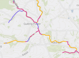
Discover where nature-based solutions can have the biggest impact in the Windrush catchment, with a powerful new interactive tool from the Cotswolds Rivers Trust: the Windrush Catchment Opportunity Modelling Platform. This powerful resource helps visualise where interventions such as floodplain reconnection, wetland creation, flood-water storage, slowing the flow and tree planting can positively impact both people and the environment.
Developed in partnership with Atkins and the Windrush Catchment Partnership, and hosted as an ArcGIS StoryMap, the platform brings together detailed open-source data on land use, hydrology and soil types across the Windrush catchment. The result is an intuitive visual guide that highlights opportunities for nature-based solutions. Whether your goal is reducing flood risk, improving water quality, supporting biodiversity, increasing carbon storage, or is often the case a mixture of them all.
For farmers, landowners, community groups, and planners, this tool provides an accessible entry point into the complex world of catchment management. Users can explore interactive maps, toggle layers to view different environmental factors, and assess where targeted action is most likely to succeed. Importantly, the modelling also begins to identify potential barriers to action, such as infrastructure, urban areas and weirs.
The Windrush has faced mounting pressures in recent years, from pollution and human modifications to habitat loss and climate change. Tackling these challenges requires a joined-up approach. The Opportunity Modelling Platform promotes exactly that, enabling a shared understanding of the opportunities out there, and where collaborations can be most effective.
This is not just a tool for technical specialists. The platform has been designed specifically for anyone interested in the future of the Windrush, from councils and citizen scientists to funders and conservation organisations. It shows opportunities from the top-down, providing that incentive for further investigation on the ground.
We believe this modelling platform will play a central role in guiding the next generation of projects in the Windrush catchment. Whether you are already involved in environmental work or are just beginning to think about how your land or community might play a part, we invite you to explore the tool and join the conversation.
Over the coming weeks we will be publicising some further in-depth articles on the different models and how they function and what opportunities they are highlighting. Keep an eye out on the Cotswolds Rivers Trust website.
This modelling has been funded by the Environment Agency’s Water Environment Improvement Fund and the Cotswolds Rivers Trust, with both organisations recognising the role this modelling can play in starting the discussions and growing projects.
Explore the Windrush Opportunity Modelling Platform here.


